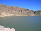
| Multi-colored cliffs wall in Lake Owyhee in the desert hills of eastern Oregon. |
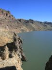
| Cliffs and rock formations line the shoreline of Lake Owyhee. |
| The Owyhee River flows through the desert hills of Eastern Oregon. |
| An old railroad bridge crosses the Malheur River. |
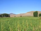
| Irrigated farmland adds a splash of green to the arid hills of eastern Oregon. |
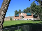
| The public school in Juntura is a historic red-brick building. |
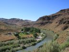
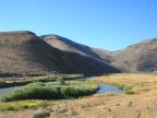
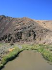
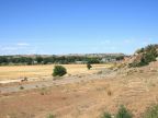
| The Malheur River loops through the sparsely vegetated hills of eastern Oregon. |
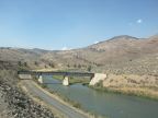
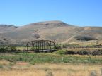
| An old steel bridge crosses the Malheur River. |
| Volcanic fumaroles stand next to the Malheur River. |
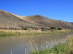
| Native grasses thrive along the banks of the Malheur River while lava can be seen on the barren hillsides in the distance. |
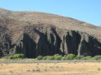
| A rough escarpment of volcanic rock rises above the Malheur River. |
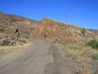
| An abandoned alignment of Highway 20 cuts through an outcropping of volcanic rock. |
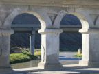
| A modern highway bridge over the Malheur River is seen through the quaint concrete arches of the old bridge. |
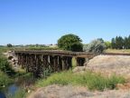
| A wooden railroad bridge crosses Bully Creek. |
| Overlooking the city of Vale. |
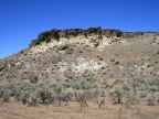
| Volcanic rocks overlook a barren hillside in eastern Oregon. |
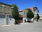
| Old brick and stone buildings line the historic streets of Vale. |
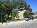
| Rinehart's stone house was built as a stop on the Oregon Trail in 1872. |