Entry Points:

About Baker County
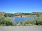
Baker County is the middle of just three counties on Oregon’s eastern border. It covers 3,088 square miles and had a population of 16,134 at the 2010 census. It is bordered on the east by the Snake River, flowing through Hell’s Canyon, one of the largest canyons in America, and rivaling the Grand Canyon in depth, at some 5,000 feet. The Blue Mountains line its eastern border.
The Oregon Trail passed through Baker County, followed by thousands of emigrants heading to the fertile Pacific Coast in the mid 1800s. Today Interstate 84 follows basically the same route. Baker City, the county seat and largest city in the county, grew up on the Oregon Trail.
Gold mining powered the original settlement of Baker County, and its original county seat was at Auburn, which then had a population of 5,000, and is now a ghost town. Ranching and logging are the major industries in the area now. Baker County was organized on September 22, 1862.
U.S. Highway 30 follows the freeway through the county, sharing the same alignment except a stretch at Baker and a short distance north. U.S. Highway 26 traverses the southern tip of Baker County.
For More Information:
See Baker County’s official website, www.bakercounty.org and the chamber of commerce site, www.visitbaker.com.
See also Wikipedia, Baker County, Oregon.
Street Index
|
F.S. Route 16 Murray Reservoir Murray Road |
U.S. Highway 26 West Camp Creek Road |