Entry Points:


About Oregon
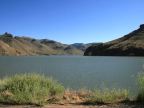
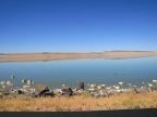
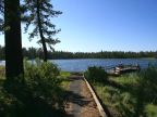
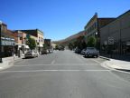
Oregon's western coast rises abruptly from the Pacific Ocean in a wall of forested mountains, drenched in rain, covered with forests, moss and thick undergrowth, and often masked by clouds and mist. Beyond the coastal mountains a fertile lowland is home to the state's largest cities, including Portland, Salem and Eugene. Beyond this the volcanic Cascade Mountains rise to 10,000-foot peaks, covered with wide evergreen forests. East of the Cascades the land is more arid, and sagebrush-covered basins are broken by ranges of mountains with forested areas. The Columbia River, one of the largest in the United States, forms most of Oregon's northern boundary.
Oregon History
The Oregon Coast was explored as early as 1543 by Juan Rodriguez Cabrillo and 1592 by Juan de Fuca. Trappers and missionaries began exploring the area around the year 1800, and the famous Lewis and Clark expedition camped near the mouth of the Columbia River in 1805.
Beginning about 1842, the beautiful and unsettled lands of Oregon became the destination of thousands of pioneers who left the crowded eastern cities to seek a new life in the west. The months-long journey by wagon along the Oregon Trail was dangerous and many lost their lives to cold, starvation, disease and Indian attacks.
In 1843, an independent government was organized with the name Oregon Country. Five years later, in 1848, it was organized as a territory of the United States. Oregon became the 33rd state of the union on February 14, 1859. The capitol is located at Salem. The population stood at 3,421,399 in the year 2000.
Oregon Geography
Oregon is roughly rectangular in shape. Washington lies to the north, Idaho to the east, and California to the south. Nevada lies to the southeast, sharing Oregon's southern border for about 100 miles. The Pacific Ocean forms the western boundary. The borders are defined by rivers in two places. The western two thirds of the northern boundary are on the Columbia River. The northern half of the eastern border is the Snake River. The Snake River originates in Yellowstone National Park, flows across Idaho, and then turns north at the Oregon border. After passing the northeast corner of Oregon, it flows into the Columbia River. Oregon's southern border lies along the 42nd line of latitude.
Two interstate routes serve Oregon. Interstate 5 passes north-south through Portland, Salem, Eugene and Medford and the other major cities just east of the coastal mountains. Interstate 84 follows the Columbia River inland from Portland and then turns southeast towards Ontario. Highway 97 passes along the eastern side of the Cascade Mountains, accessing the cities of Klamath Falls and Bend, and passing by Crater Lake. U.S. Highway 395 passes through the deserts of the south-eastern part of Oregon and heads north to the Columbia River. U.S. Highway 20 passes east-west through Oregon, following the Malheur River into the Harney Basin, reaching the Cascades near Bend, and ending at the Pacific Coast at Newport.
What to See in Oregon
One of the earliest National Parks is found in Oregon. Crater Lake is one of the world's deepest lakes, formed in the collapsed caldera of an ancient volcano. Surrounded by cliffs, forests and alpine meadows, it is one of America's scenic treasures.
The Columbia River Gorge, as it passes through the Cascade Mountains, is one of the most beautiful and dramatic canyons in America. The Columbia River, being one of the most important rivers in the United States, flows out of the Rocky Mountains and drains much of the northwest. The gorge is filled with lush vegetation, lined by towering mountains and waterfalls.
The Pacific coast is rugged and humid, as clouds drop their first rain on the slopes of the Coastal Mountains. U.S. Highway 101 makes the narrow and sometimes difficult passage between the mountains and the ocean.
For More Information:
Go to www.Oregon.gov for Oregon's official site. See also Wikipedia's Oregon article.
|
|