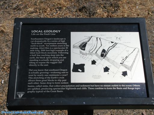
Local Geology
Live on the Fault Line
Southeastern Oregon's landscape is
cut dramatically by a series of high
"fault-block' escarpments stretching
north to south. Ten million years in the
making, Abert Rim is a spectacular 30
mile long, 2000 foot high example of a
tilted fault-block mountains. Following
a fault line reaching deep into the
earth, the block upon which you are
standing is actually dropping and
tilting to expose the rugged cliff
directly to the east.
Did you know that southeast Oregon
is actually growing—widening east to
west by nearly one centimeter a year?
This stretching of the Earth's crust
allows these great blocks to slip past
each other. Some drop to form sunken
basins, called sinks, that collect precipitation and sediment but have no stream outlets to the ocean. Others
are uplifted, producing spectacular highlands and cliffs. These combine to form the Basin and Range
topography typical of the Great Basin.