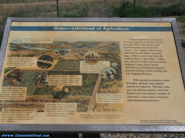
Water—Lifeblood of Agriculture
Irrigated agriculture has been an
economic mainstay in Malheur County
since the 1860s, when farmers first
began diverting water from local
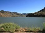
streams. The irrigation ditch below,
called the Nevada Ditch, was hand-
dug in 1881 to carry water from the
Malheur River to this valley. Today,
after decades fo effort and investment,
Malheur County boasts nearly
300,000 acres of farmland irrigated
from the Owyhee, Warm Springs and
Vale Irrigation Projects.
With annual precipitation under
10 inches, all local crops depend
entirely on irrigation. Efficient water
use is an obvious priority, and local
farmers have developed a number of
innovative conservation techniques
and management practises.
Reservoirs. Large reservoirs in the hills
provide recreation opportunities as well as
water to the fields below.
Straw Mulching. Straw mulch in
irrigation furrows reduces erosion and
increases efficiency—it also reduces
phosphorus and nitrogen returning to the
river or ground water from the fields.
Tailwater Recovery Systems.
Ponds located at the lowest end of a
farm or field capture run-off, which is
then pumped back to the top of the field
for re-use. The ponds provide habitat
for waterfowl and other wildlife.
Gravity-Flow Systems. Although
sprinkler systems are used, most irrigation
water is applied through a surface system
utilizing curved aluminum siphon tubes
or from PVC pipes with gates.
Turbulent Fountain Trash
Screens or Bubble-ups. These
devices remove debris from water
to keep pipes and valves open—
they also help remove weed seeds
and reduce herbicide use.
Concrete Ditches. Hundreds of
miles of concrete ditches have been
installed to control seepage and
improve application efficiency.
Filter Strips. Narrow strips of grain
planted across the tops and bottoms of
furrow-irrigated fields develop
extensive root systems that hold soil
in place to recude erosion—they also
provide habitat for pheasants.
Water Mark Sensors. Electrical devices
are placed in the roof zone to measure
water in the soil, and together with
experience and crop knowledge, they help
farmers decide when to irrigate and how
much water to use.
Field Leveling. Thousands of acres have been leveled
to establish uniform grades for better water control.