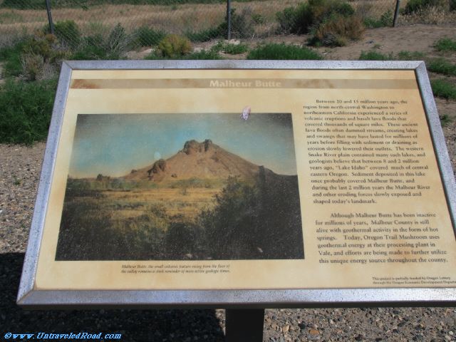
Malheur Butte
Between 20 and 15 million years ago, the
region from north-central Washington to
northeastern California experienced a series of
volcanic eruptions and basalt lava floods that
convered thousands of square miles. These ancient
lava floods often dammed streams, creating lakes
and swamps that may have lasted for millions of
years before filling with sediment or draining as
erosion slowly lowered their outlets. The western
Snake River plain contained many such lakes, and
geologists believe that between 8 and 2 million
years ago, "Lake Idaho" covered much of central
eastern Oregon. Sediment deposited in this lake
once probably covered Malheur Butte, and
during the last 2 million years the Malheur River
and other eroding forces slowly exposed and
shaped today's landmark.
Although Malheur Butte has been inactive
for millions of years, Malheur County is still
alive with geothermal activity in the form of hot
springs. Today, Oregon Trail Mushroom uses
geothermal energy at their processing plant in
Vale, and efforts are being made to further utilize
this unique energy source throughout the county.
Malheur Butte, the small volcanic feature rising from the floor of
the valley remains a dark reminder of more active geologic times.